Perl The syntax format is as follows: The following is Next, it will judge After the execution The conditions are judged again. If for Here, Execute the above program, and the output is as follows:
for
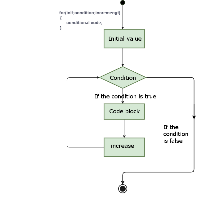
loops are used to execute a sequence of statements multiple times, simplifying the code that manages loop variables. 5.21.1. Grammar #
for ( init; condition; increment ){
   statement(s);
}
for
analysis of the control flow of the loop:
init
will be executed first, and only once. This step allows you to declare and initialize any loop control variables. You can also not write any statements here, as long as a semicolon appears.
condition
. If for
true
loop body is executed if for
false
The loop body is not executed, and the control flow jumps to the following
for
next statement of the loop.
for
after looping the body, the control flow jumps back to the
increment
statement. This statement allows you to update loop control variables. This statement can be left blank as long as a semicolon appears after the condition.
true
loop is executed, and the process is repeated over and over again (loop body, then increase the step value, and then rejudge the condition) when the condition becomes
false
,
for
cycle ends.
statement(s)
can be a single statement or a block of code madeup of several statements.
condition
can be any expression when the condition is
true
the loopis executed when the condition is
false
, exit the loop. 5.21.2. Flow chart #
Example #
#!/usr/bin/perl# execute for
circulatefor($a=0;$a<10;$a=$a+1){print"a's value is:$a\\n";}
The value of a is: 0
The value of a is: 1
The value of a is: 2
The value of a is: 3
The value of a is: 4
The value of a is: 5
The value of a is: 6
The value of a is: 7
The value of a is: 8
The value of a is: 9