China Nature Disaster
2023-08-23
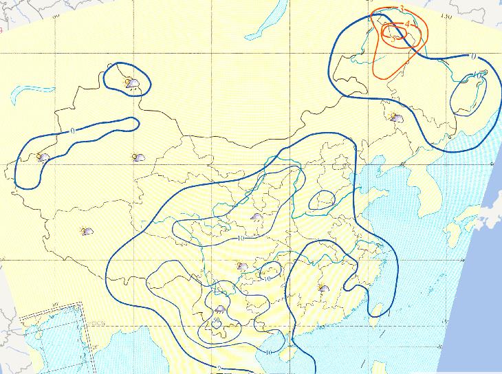
The most common pattern of drought and flood in China is "drought
in the north and waterlogging in the South", which may occur on...
2023-08-23
Map source
The online map of green tide distribution of marine disasters on
July 14, 2014 comes from Atlas of natural disasters i...
2023-08-23
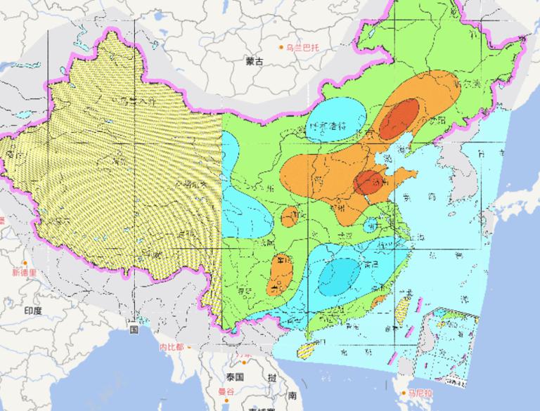
Online map of the types of droughts and
floods in China during 1951-1980.
...
2023-08-23
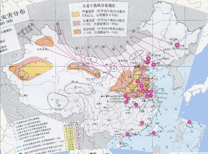
Source of Sandstorm Source in Qinghai - Tibet Plateau
① northern Tibet Plateau
② Yangtze River - Yellow River source area
Sources ...
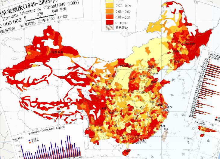
2023-08-23
Map of Drought Frequency in China (1949-2005)...
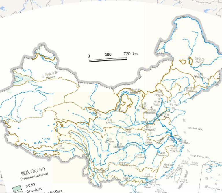
2023-08-23
Online map of flood frequency in China during the winter (1949-2000)...
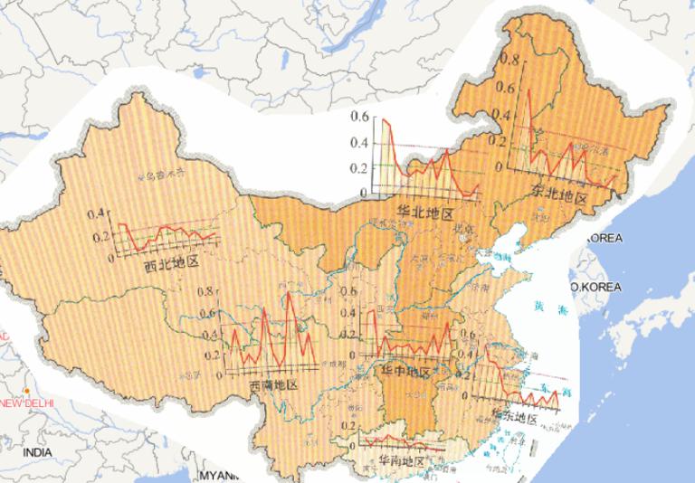
Online map of spatial and temporal distribution of drought disaster index by region in China in 2014
2023-08-23
Map source
The online map of spatial and temporal distribution of drought
disaster index by region in China in 2014 is from
the A...
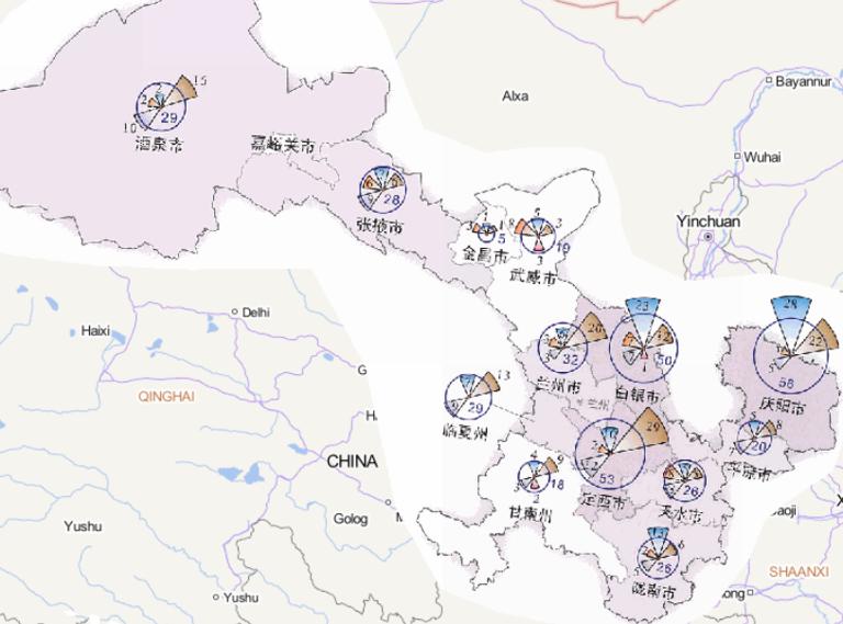
2023-08-23
Map source
The online map of disaster frequency distribution by disaster type
in Gansu Province in 2014 is from the Atlas of natur...
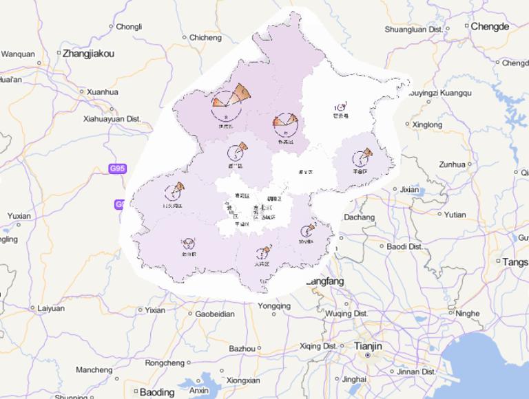
2023-08-23
Map source
The online map of disaster frequency distribution by disaster type
in Beijing in 2014 is from the Atlas of natural disa...
2023-08-23
This map comes from the Major natural disaster Atlas of China in 2010
Surveying and Mapping Press and China Map Publishing House....