Toggle navigation
GISLite
Document
Info
Tutorial
App
Map
User
Recent use
Most use
My collection
Personal Data
Login
Register
Current location:
Home
Map
Geological Disasters
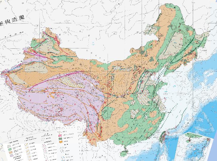
New tectonic online map of China
2023-08-23
New tectonic online map of China Up and down zones since Pliocene Subsidence area since Pliocene Upward Height of 0-500 m since Pl...
Online map of plate tectonics in China
2023-08-23
Plate tectonics is a modern geoscience theory. It originated in the 1960s. Plate tectonics believe that the Earth's surface (lith...
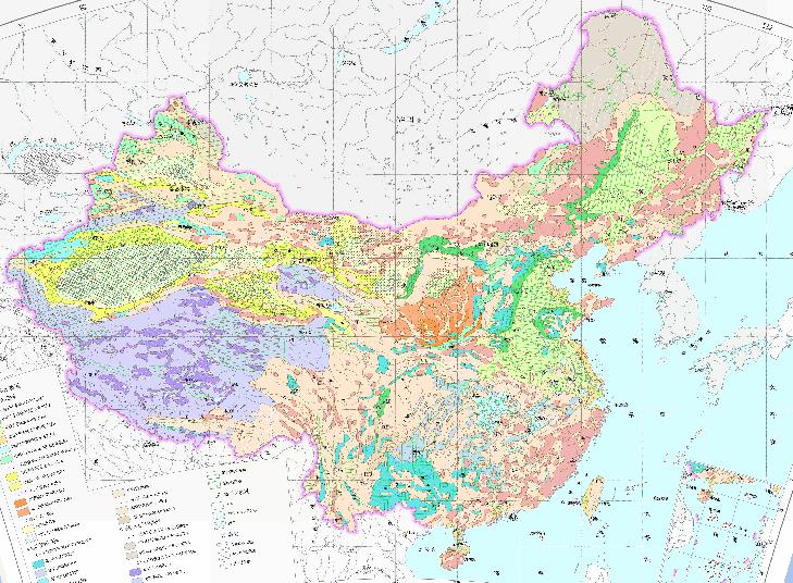
Chinese hydrogeological terrain map
2023-08-23
In the map, we can see the hydrographic map of China.The scale of the map is 1:14000000. The descriptive datas of the map are the...
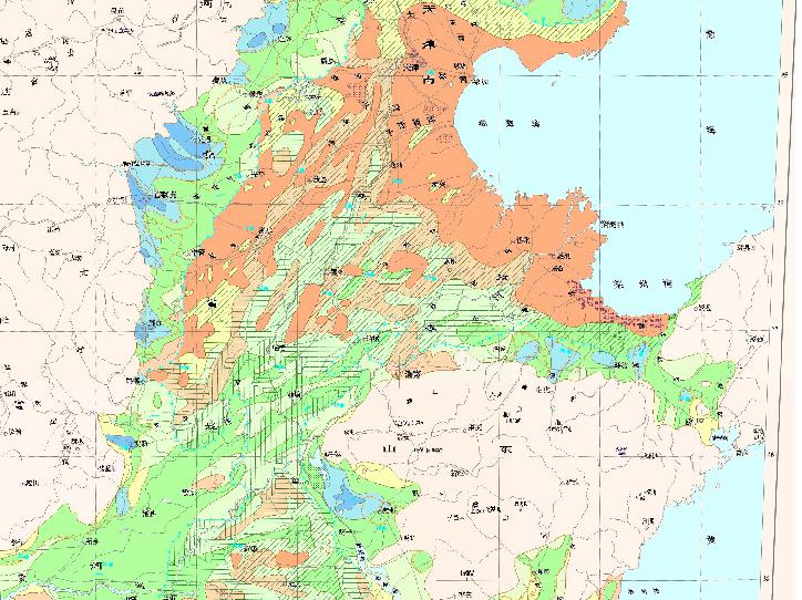
Hydrogeological online map of shallow freshwater in Huang - Huai - Hai Plain
2023-08-23
Hydrogeological map of shallow freshwater in Huang - Huai - Hai Plain...
Hydrogeological map of Jiangsu Province, China
2023-08-23
In the map, we can see the map of hydrogeological map of Jiangsu Province, China. The scale of the map is 1:1750000.The descriptiv...
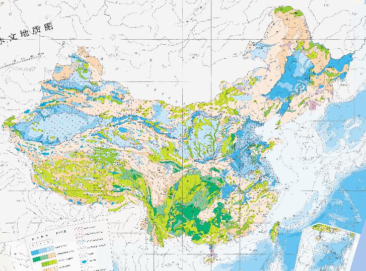
Hydrographic map of China
2023-08-23
In the map, we can see the map of Hydrographic map of China. The descriptive datas of the map are water bearing rock group and ...
Geological Map of Hebei Province, China
2023-08-23
Geological Map of Hebei Province, China ...
Geological Online Map of Yunnan Province, China
2023-08-23
Geological Map of Yunnan Province, China Gondwana Plate Tengchong plate Baoshan plate South China Plate Simao Block Zhongdian Indo...
Online Map of Hydrogeology in Inner Mongolia Autonomous Region
2023-08-23
In the map, we can see the map of Hydrogeological map of Inner Mongolia Autonomous Region. The scale of the map is 1:3000000. The ...
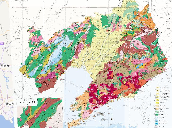
Geological Map of Liaoning Province, China
2023-08-23
Geological Map of Liaoning Province, China The stratum includes: Quaternary, Tertiary, Cretaceous, Jurassic, Triassic, Permian, Ca...
1
2
3
4
5
6
7
8
9
10
Next page
End
Most attention
Differences between WebGIS and desktop GIS, mobile GIS and 3D GIS
3D WebGIS-technology route
Differences between C language/ C++ / Java / Python
GIS spatial data sharing standard
Top 10 free open source NoSQL databases
Recent articles
Analysis of the development prospects of GIS in urban planning
The application of big data in the construction of smart cities
Making GIS 3D visualization simple - projected coordinate system
Making GIS 3D visualization simple - geographic coordinate system
What are the advantages of 3D GIS compared to 2D
Classified catalogue
Programming and development
Software application
Open source GIS
Space Technology
OpenGIS
Education and training
Python
JavaScript
Desktop
Database
WebGIS
Powered by TorCMS (
https://github.com/bukun/TorCMS
).