Application of surveying and mapping remote sensing
Page Views: Stats unavailable
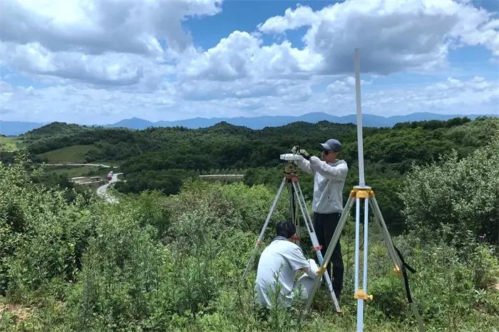
1.Application Status of Surveying and Mapping Remote Sensing Technology in Work
The surveying and mapping work mainly focuses on environmental detection, disaster prevention, geological exploration, etc. Modern surveying and mapping remote sensing technology developed in the 1950s. With the continuous improvement of the application scope of surveying and mapping remote sensing technology, the current surveying and mapping remote sensing technology has many problems, which greatly restricts the improvement of surveying and mapping remote sensing technology.
1.1 Mapping and remote sensing technology is not widely used
After years of development, the prospect of surveying and mapping remote sensing technology is very optimistic, and the continuous improvement of technical level makes the application technology expand continuously. However, as far as the current situation is concerned, we are faced with important development problems, mainly manifested in the scope of application is not wide enough. Surveying and mapping remote sensing technology is not well known by current people because of its special use. In the process of geological exploration, traditional geological surveying and mapping technology is also used for geological surveying and engineering exploration. The application of surveying and mapping remote sensing technology is not extensive enough, and its use is limited to some extent. Conceptual constraints make it difficult for surveying and mapping remote sensing technology to play its role in other fields, which is more unfavorable to the promotion of surveying and mapping remote sensing technology.
1.2 The poor application of surveying and mapping remote sensing technology is not conducive to the collection of spatial information resources
Surveying and mapping remote sensing technology is mainly based on the development of spatial information technology, which can reflect many advantages of surveying and mapping remote sensing technology in spatial development, and further enhance and extend the function of spatial information technology. Surveying and mapping remote sensing technology uses space technology for positioning and navigation, which can enhance the accuracy of surveying and mapping remote sensing technology in exploration work.
1.3 High cost of surveying and mapping and remote sensing technology
The cost increase of surveying and mapping remote sensing technology restricts the further improvement of surveying and mapping work. With the continuous improvement of surveying and mapping remote sensing technology and the development of computer technology, surveying and mapping remote sensing technology has developed from the experimental stage to the technical application stage, and the functions of environmental detection, geological exploration and other functions have become more prominent. But in the surveying and mapping work, the surveying and mapping remote sensing technology has not been applied to the actual work. The main reason is that the cost of surveying and mapping remote sensing technology is high, and surveying and mapping remote sensing technology is mainly used in key scientific research projects in key departments. For example, the management of natural resources and environment and the development of geological exploration are surveyed.
1.4 Improve the application of surveying and mapping remote sensing technology in practical work
With the further popularization of surveying and mapping and remote sensing technology in practical work, the problems of surveying and mapping and remote sensing technology in work are gradually emerging. The emergence of this phenomenon can improve the level of surveying and mapping and remote sensing technology, accelerate the implementation of technology promotion, and is an important method to improve the application of surveying and mapping and remote sensing technology in practical work.
2.Features of Remote Sensing Technology
- Large area synchronous observation. When conducting resource and environment survey and dynamic monitoring of land and resources, the data obtained from large-scale synchronous observation is the most valuable. According to the traditional ground survey, the implementation is very difficult and the workload is very large. The data information on the cloud platform of the remote sensing market can provide the best way to obtain information for this purpose, and is not restricted by terrain and ground objects.
- Timeliness. Remote sensing detection, especially space remote sensing detection, can repeatedly detect the same area in a short time, and find the dynamic changes of many things in the detection area. For example, remote sensing dynamic monitoring, using data from Earth resource satellites (such as Landsat in the United States, spot in France, etc.), dynamic changes and data in several years, one year or several months can be obtained in a very short time after processing. On the other hand, traditional ground survey requires a large amount of manpower and material resources to obtain a large range of regional dynamic change data in a year. Therefore, remote sensing greatly improves the timeliness of observation.
- The comprehensiveness of remote sensing information. The electromagnetic wave characteristic information of ground objects obtained by remote sensing comprehensively reflects many natural and human information on the ground. Infrared remote sensing can be detected day and night, and microwave remote sensing can be detected all day, so people can selectively extract the required information. The electromagnetic wave characteristics of ground objects obtained from earth resource satellites can comprehensively reflect the characteristics of geology, geomorphology, soil, vegetation, hydrology and so on, and have broad applications.
- Economy. Compared with traditional methods, remote sensing can greatly save manpower, material resources, financial resources and time, and has high economic and social benefits.
3.Application of surveying and mapping remote sensing technology in actual work
With the continuous improvement of science and technology, the application scope of surveying and mapping remote sensing technology is becoming wider and wider. Compared with traditional surveying and mapping technology, surveying and mapping remote sensing technology has obvious technical advantages, which can greatly avoid the work drawbacks brought by traditional surveying and mapping technology. The use of surveying and mapping remote sensing technology can detect a wide area, which can objectively reflect the geological situation of the area where the surveying and mapping is located, and obtain more comprehensive material resources. Surveying, mapping and remote sensing technology can monitor the climate and geology dynamically in real time. The biggest feature of surveying and mapping remote sensing technology is that it can use the global positioning system as the technical support, to locate the region and then conduct real-time dynamic detection all day long. For example, the detection of environmental pollution in the mining area can collect the dynamic detection data report of the line pipe, so as to provide effective data support for the treatment of environmental pollution in the mining area. Surveying and mapping remote sensing technology, based on actual work conditions, receives less human intervention and can objectively reflect the actual situation in the monitoring area.
3.1 Promote the upgrading and optimization of mapping and remote sensing technology
Increase the popularization of surveying, mapping and remote sensing technology. Only by increasing the popularization of surveying and mapping remote sensing technology, can we achieve the comprehensive improvement of surveying and mapping remote sensing work. With the development of the times, surveying and mapping remote sensing technology has shown strong vitality and technological advantages to adapt to the environment. It can carry out exploration work in complex geological environment, and achieve real-time monitoring of various disaster processes, obtain dynamic resource data, which provides convenience for geological disaster investigation and the establishment of disaster prevention system. Therefore, it is necessary to increase the improvement of surveying and mapping remote sensing technology, fully popularize surveying, mapping and remote sensing technology. Surveying and mapping personnel should reduce the cost input of remote sensing technology, and realize the application of surveying and mapping remote sensing technology in the industry by reducing the cost input of surveying and mapping remote sensing technology. Only by correspondingly reducing the budget input of funds can more and more industries choose surveying and mapping remote sensing technology.
3.2 Comprehensively improve spatial resolution
Comprehensively improving the spatial resolution of surveying and mapping remote sensing technology will help to further improve the application of surveying and mapping remote sensing technology in surveying and mapping work. The traditional surveying and mapping remote sensing technology is affected by many aspects, most of which are only macro inspections. However, due to the development of technology and the application of new work ideas, the degree of integration of surveying and mapping remote sensing technology with geology is getting higher and higher, and the restrictions are getting less and less. However, as surveying and mapping geological workers, they should improve the relevant work ideas and improve the application of surveying and mapping remote sensing technology in surveying and mapping.
4.Conclusion
The continuous improvement of computer technology has played a positive role in promoting the R&D and popularization of mapping and remote sensing technology. The surveying and mapping work mainly monitors and observes the environmental resources and geological exploration. Surveying and mapping remote sensing technology has been accepted by more and more surveying and mapping workers because of its wide range of surveying and mapping, dynamic monitoring advantages and objective and true data resources obtained, which has promoted the development of the surveying and mapping industry. Surveying, mapping and remote sensing technology is mainly applied to the promotion and use of spatial information technology, which provides great convenience for obtaining the dynamic changes of geological resources. The development of surveying, mapping and remote sensing technology provides powerful resource information for national security, social development and economic construction. This paper analyzes the current development of surveying and mapping remote sensing technology, and puts forward relevant measures to improve surveying and mapping remote sensing technology.