Flood Disasters
2023-08-23
Map source
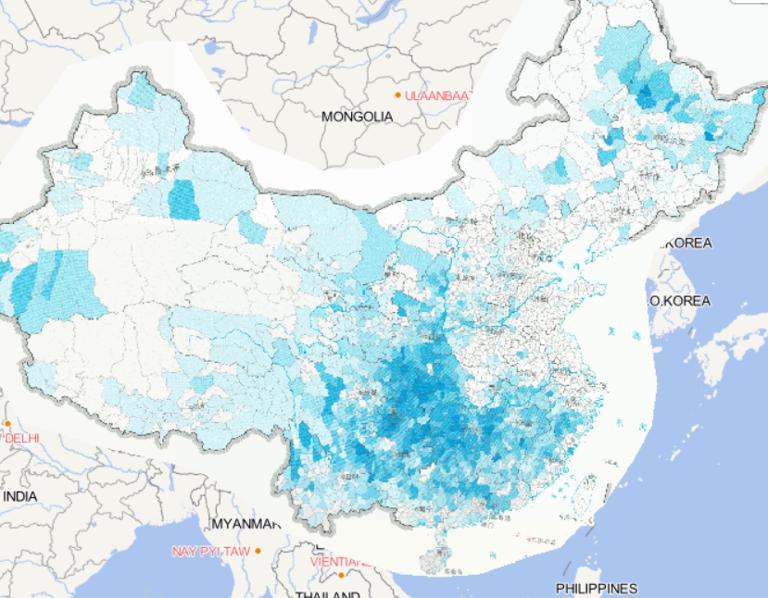
The online map of the distribution of floods and geological disasters in
China in 2014 is from the Atlas of natural di...
2023-08-23
Map source
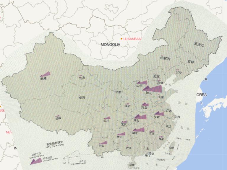
The online map of flood and geohazard affected housing by province in China in 2016
comes from the Atlas of China's Nat...
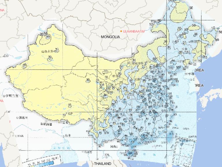
2023-08-23
Map source
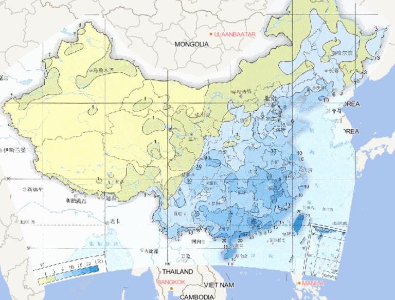
The online map of the maximum annual rainstorm
days in China from 1961 to 2015 comes from
China Severe Weather and Cl...
2023-08-23
Map source
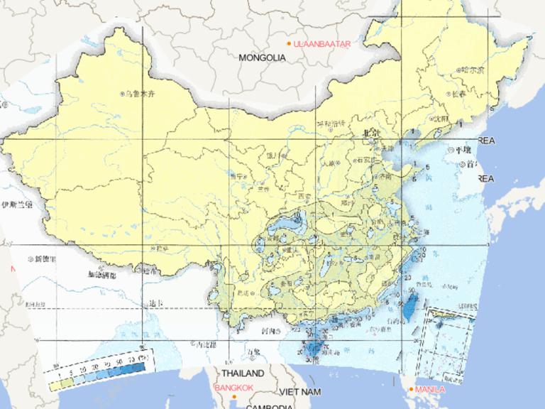
The online map of autumn rainfall and waterlogging
frequency in China from 1981 to 2010 comes from
China Severe Weath...

2023-08-23
Map source
The online map of maximum daily precipitation
in China from 1961 to 2015 comes from
China Severe Weather and Climate ...
2023-08-23
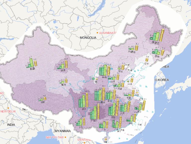
Map source
The online map of flood and geohazard caused death toll by county in China in 2016
comes from the Atlas of China's Natu...
2023-08-23
Map source
The online map of house damage and economic losses caused by flood and
geological disasters in China in 2014 is from t...

2023-08-23
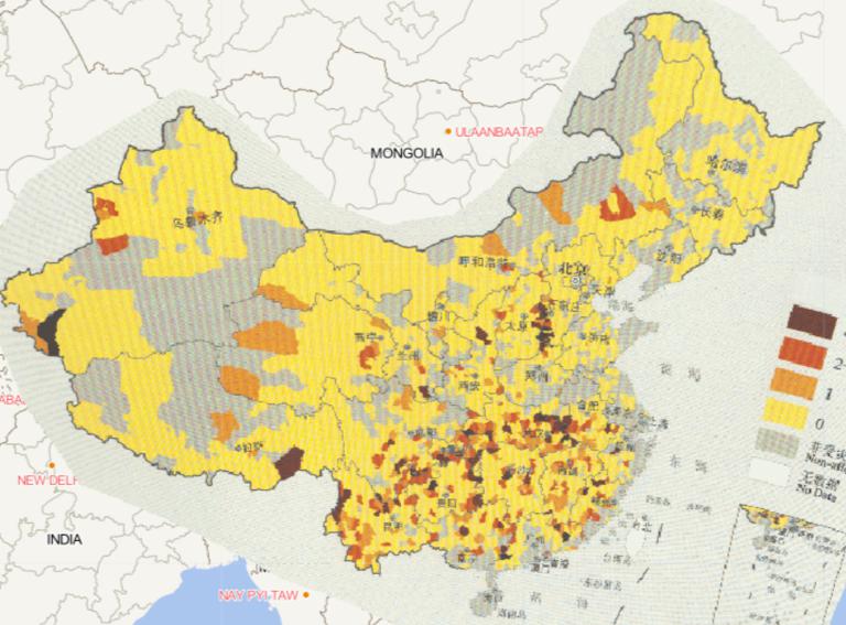
Map source
The online map of frequency distribution of floods and geological disasters
in China in 2014 is from the Atlas of natu...
2023-08-23
Map source
The online map of maximum hourly precipitation
in China from 1961 to 2015 comes from
China Severe Weather and Climate...
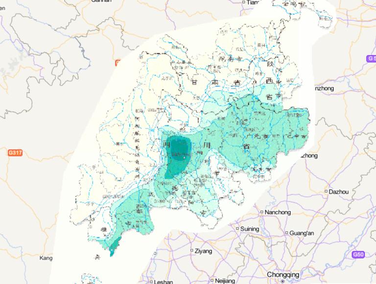
2023-08-23
Map source
Online map of annual rainstorm and flood frequency in
Wenchuan disaster area in China comes from the Wenchuan Earthquak...