China Historical Disaster
2023-08-23
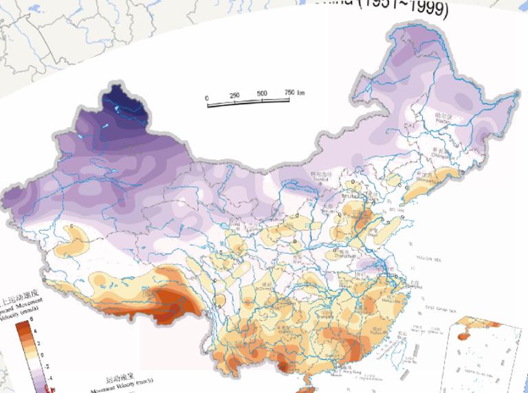
Online map of vertical land movement speed in China (1951-1999)....

2023-08-23
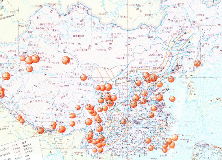
Historical map of high-frequency flood disaster areas in China (1912-1949)...
2023-08-23
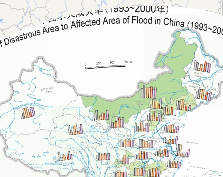
China flood disaster rate online map (1993 to 2000)...
2023-08-23
Map source
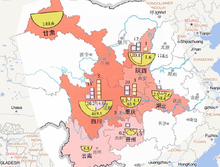
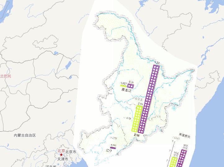
The online map people affected by flood disaster in West China
in mid to early September 2014 is from
the Atlas of natu...
2023-08-23
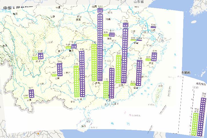
This map comes from the Major natural disaster Atlas of China in 2010
Surveying and Mapping Press and China Map Publishing House....
2023-08-23
This map comes from the Major natural disaster Atlas of China in 2010
Surveying and Mapping Press and China Map Publishing House....
2023-08-23
Drought, floods, earthquakes and geological hazards online map of China in the Qing Dynasty
Qing Dynasty (1644-1911), a total of 2...
2023-08-23
This map comes from the Major natural disaster Atlas of China in 2010
Surveying and Mapping Press and China Map Publishing House....
2023-08-23
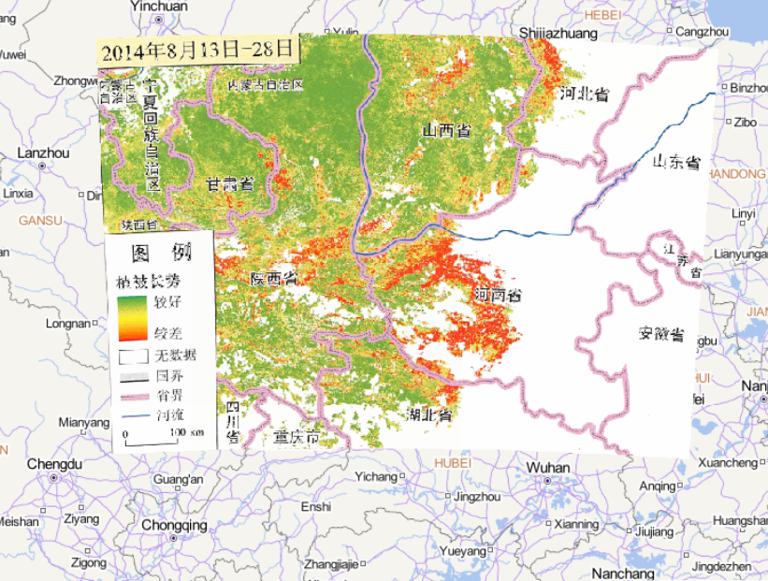
Map source
The online map of vegetation growth in central and Western Henan
and southern Shaanxi from August 13 to 28, 2014, it is...
2023-08-23
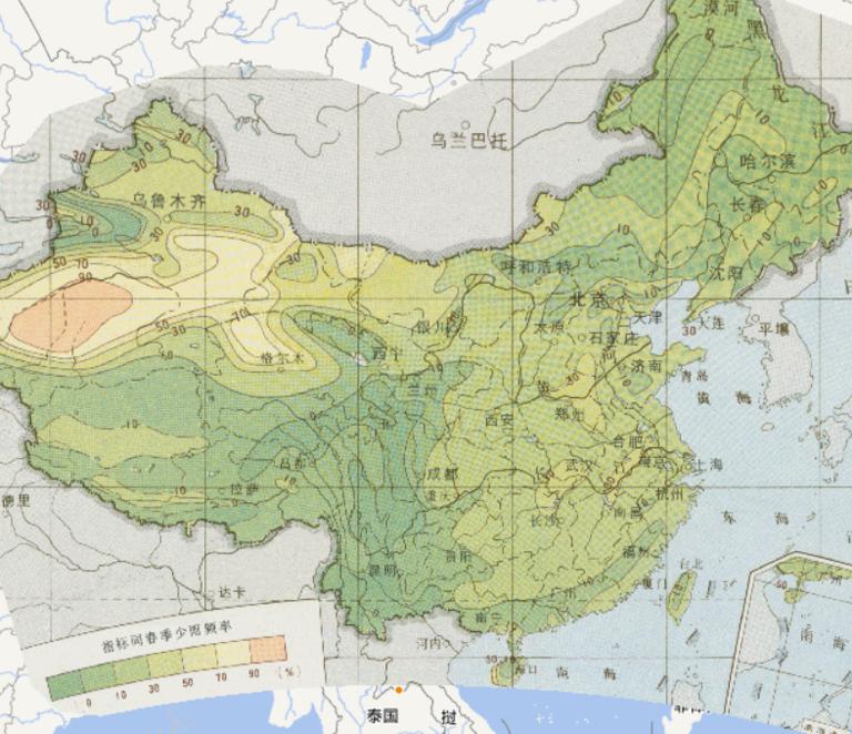
Summer few rain frequency online map of China's
agricultural meteorological disasters
was derived from the National
Agricultural ...